We were the first geosteering company, and still the best.
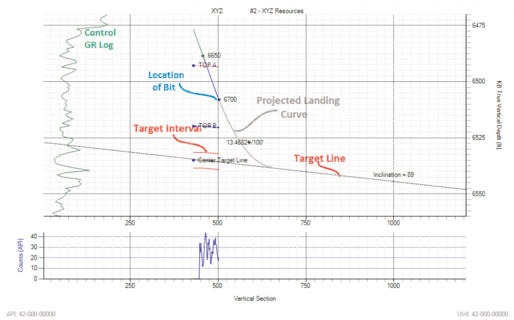
TerraVu is an interactive software system designed to assist professional staff in navigating a horizontal well to a stratigraphic target and to keep the well on target to a successful TD. The geosteering is accomplished using an offset or pilot well to establish a model of the stratigraphy in the vicinity of the drilling well and then using fast, iterative geometrical projection to remove the stretching of the measured depth log data to allow a true stratigraphic thickness (TST) correlation.
With an accurate correlation of the MWD data, a precise calculation of target structure can be immediately obtained. Specifically, the data is projected to a correlation with the model by altering the dip of the strata and by interpreting faults where the correlation or data discontinuities indicate. As the well is drilled, the target structure is mapped on a cross sectional display, and updated in real time based on the most current well data. This gives all responsible parties the most accurate possible picture of the current position of the drillbit with respect to the target, based on your drilling data and geological knowledge of the area.
Overview
A distinct advantage of the TerraVu method over previous methods lies in its fast and intuitive log correlation display capabilities (Fig. 2). Immediate displays of the effect of a given dip change or fault correlation on structure make the choice of various interpretive options fast and accurate. This greatly increases the efficiency of communication between geologists and drilling personnel, reducing the likelihood of expensive drilling errors. Variations in the vintage or quality of the logs correlated can be accommodated through scaling and filtering functions which can be applied to either the offset log or the horizontal log.
Horizontal Log View 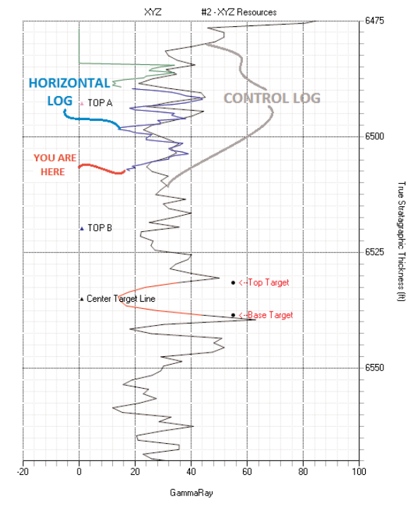
Offset Log View